
- Start >
- Groundwater >
- Waterlevel of upper layer >
- Oberer Main - Elbe >
- KULMBACH Blaich 5 >
- Chart of total period

Chart of total period KULMBACH Blaich 5
Groundwater levels of the total period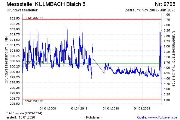
Groundwater level [m above sealevel]: 299.79
Distance to surface [m]: 4.40
Last value from 10.05.2026 06:00
Ground level [m above sealevel]: 304.19
| Date | Groundwater level [m above sealevel] |
|---|---|
| 09.05.2026 | 299.79 |
| 08.05.2026 | 299.81 |
| 07.05.2026 | 299.87 |
| 06.05.2026 | 299.85 |
| 05.05.2026 | 299.84 |
| 04.05.2026 | 299.82 |
| 03.05.2026 | 299.82 |
| 02.05.2026 | 299.81 |
© Bayerisches Landesamt für Umwelt 2026