
- Start >
- Groundwater >
- Waterlevel of upper layer >
- Oberer Main - Elbe >
- KULMBACH Blaich 4 >
- Chart of total period

Chart of total period KULMBACH Blaich 4
Groundwater levels of the total period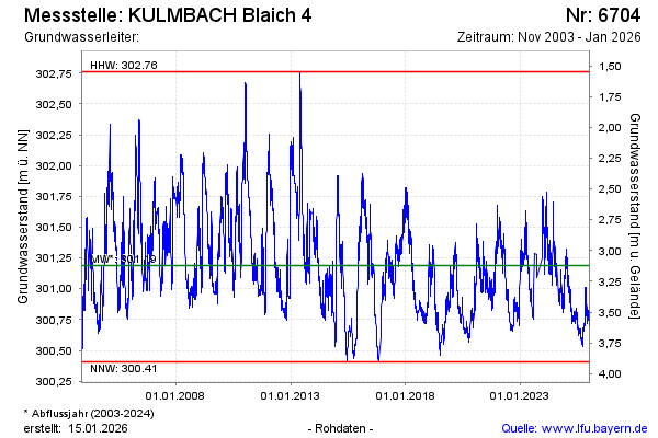
Groundwater level [m above sealevel]: 300.83
Distance to surface [m]: 3.48
Last value from 22.01.2026 10:00
Ground level [m above sealevel]: 304.31
| Date | Groundwater level [m above sealevel] |
|---|---|
| 22.01.2026 | 300.84 |
| 21.01.2026 | 300.83 |
| 20.01.2026 | 300.80 |
| 19.01.2026 | 300.80 |
| 18.01.2026 | 300.79 |
| 17.01.2026 | 300.77 |
| 16.01.2026 | 300.76 |
| 15.01.2026 | 300.74 |
© Bayerisches Landesamt für Umwelt 2026