
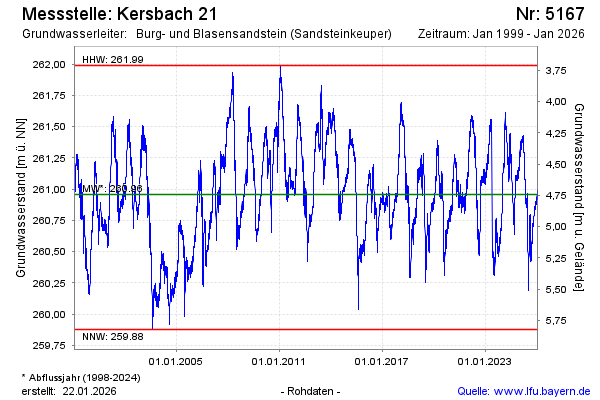
Chart of total period Kersbach 21
Groundwater level [m above sealevel]: 260,56
Distance to surface [m]: 5,14
Last value from 23.07.2026 10:00
Ground level [m above sealevel]: 265.70
| Date | Groundwater level [m above sealevel] |
|---|---|
| 23.07.2026 | 260.57 |
| 22.07.2026 | 260.57 |
| 21.07.2026 | 260.56 |
| 20.07.2026 | 260.55 |
| 19.07.2026 | 260.53 |
| 18.07.2026 | 260.51 |
| 17.07.2026 | 260.49 |
| 16.07.2026 | 260.47 |