
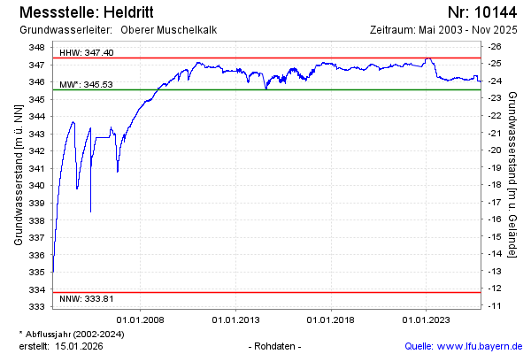
Chart of total period Heldritt
Groundwater level [m above sealevel]: 346.02
Distance to surface [m]: -23.95
Last value from 10.06.2026 13:23
Ground level [m above sealevel]: 322.07
| Date | Groundwater level [m above sealevel] |
|---|---|
| 10.06.2026 | 346.03 |
| 09.06.2026 | 346.03 |
| 08.06.2026 | 346.03 |
| 07.06.2026 | 346.03 |
| 06.06.2026 | 346.02 |
| 05.06.2026 | 346.02 |
| 04.06.2026 | 346.01 |
| 03.06.2026 | 346.02 |