
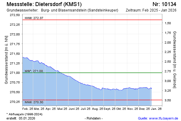
Current data Dietersdorf (KMS1)
Groundwater level [m above sealevel]: 270.69
Distance to surface [m]: 3.1
Last value from 24.06.2026 10:00
Ground level [m above sealevel]: 273.79
| Date | Groundwater level [m above sealevel] |
|---|---|
| 29.06.2026 | 270.65 |
| 28.06.2026 | 270.65 |
| 27.06.2026 | 270.66 |
| 26.06.2026 | 270.67 |
| 25.06.2026 | 270.68 |
| 24.06.2026 | 270.69 |
| 23.06.2026 | 270.69 |
| 22.06.2026 | 270.69 |