
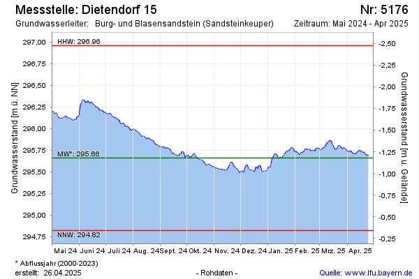
Current data Dietendorf 15
Groundwater level [m above sealevel]: 295.28
Distance to surface [m]: -0.79999999999995
Last value from 24.06.2026 09:00
Ground level [m above sealevel]: 294.48
| Date | Groundwater level [m above sealevel] |
|---|---|
| 28.06.2026 | 295.27 |
| 27.06.2026 | 295.27 |
| 26.06.2026 | 295.28 |
| 25.06.2026 | 295.28 |
| 24.06.2026 | 295.29 |
| 23.06.2026 | 295.29 |
| 22.06.2026 | 295.28 |
| 21.06.2026 | 295.28 |