

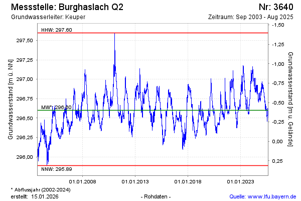
Chart of total period Burghaslach Q2
Groundwater level [m above sealevel]: 294,59
Distance to surface [m]: 1,61
Last value from 02.07.2026 12:25
Ground level [m above sealevel]: 296.20
| Date | Groundwater level [m above sealevel] |
|---|---|
| 02.07.2026 | 296.50 |
| 01.07.2026 | 296.54 |
| 30.06.2026 | 296.54 |
| 29.06.2026 | 296.54 |
| 28.06.2026 | 296.52 |
| 27.06.2026 | 296.51 |
| 26.06.2026 | 296.54 |
| 25.06.2026 | 296.55 |