
Chart of total period BURGEBRACH 232
Groundwater level [m above sealevel]: 264,86
Distance to surface [m]: 2,08
Last value from 23.07.2026 09:00
Ground level [m above sealevel]: 266.94
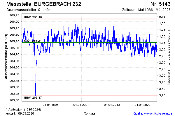
| Date | Groundwater level [m above sealevel] |
|---|---|
| 23.07.2026 | 264.84 |
| 22.07.2026 | 264.88 |
| 21.07.2026 | 264.90 |
| 20.07.2026 | 264.91 |
| 19.07.2026 | 264.99 |
| 18.07.2026 | 264.94 |
| 17.07.2026 | 264.81 |
| 16.07.2026 | 264.79 |