
- Start >
- Groundwater >
- Waterlevel of upper layer >
- Oberer Main - Elbe >
- BUCHAU-BT-kms1 >
- Chart of total period

Chart of total period BUCHAU-BT-kms1
Groundwater levels of the total period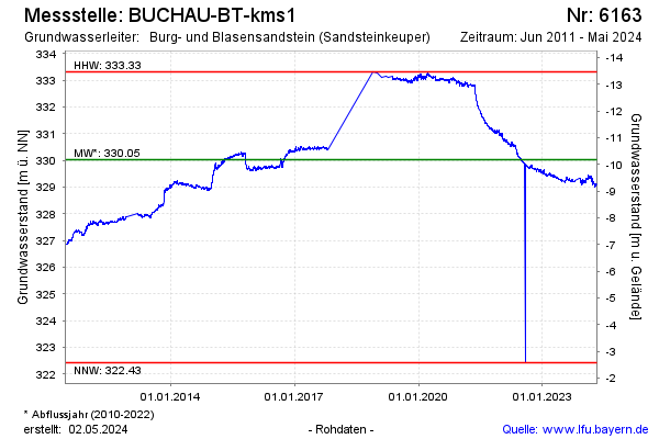
Groundwater level [m above sealevel]: 328.43
Distance to surface [m]: -8.57
Last value from 23.05.2026 10:00
Ground level [m above sealevel]: 319.86
| Date | Groundwater level [m above sealevel] |
|---|---|
| 23.05.2026 | 328.46 |
| 22.05.2026 | 328.46 |
| 21.05.2026 | 328.47 |
| 20.05.2026 | 328.49 |
| 19.05.2026 | 328.51 |
| 18.05.2026 | 328.53 |
| 17.05.2026 | 328.53 |
| 16.05.2026 | 328.57 |
© Bayerisches Landesamt für Umwelt 2026