
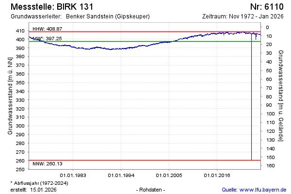
Chart of total period BIRK 131
Groundwater level [m above sealevel]: 404.21
Distance to surface [m]: 9.81
Last value from 14.07.2026 10:00
Ground level [m above sealevel]: 414.02
| Date | Groundwater level [m above sealevel] |
|---|---|
| 14.07.2026 | 404.20 |
| 13.07.2026 | 404.12 |
| 12.07.2026 | 404.26 |
| 11.07.2026 | 404.16 |
| 10.07.2026 | 404.33 |
| 09.07.2026 | 404.24 |
| 08.07.2026 | 404.48 |
| 07.07.2026 | 404.41 |