
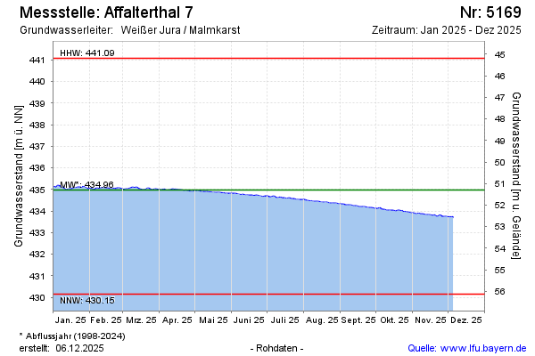
Current data Affalterthal 7
Groundwater level [m above sealevel]: 433.17
Distance to surface [m]: 53.1
Last value from 03.06.2026 09:00
Ground level [m above sealevel]: 486.27
| Date | Groundwater level [m above sealevel] |
|---|---|
| 03.06.2026 | 433.18 |
| 02.06.2026 | 433.20 |
| 01.06.2026 | 433.17 |
| 31.05.2026 | 433.19 |
| 30.05.2026 | 433.18 |
| 29.05.2026 | 433.16 |
| 28.05.2026 | 433.17 |
| 27.05.2026 | 433.18 |