
- Start >
- Groundwater >
- Waterlevel of upper layer >
- Bayern >
- WULLENSTETTEN 751 >
- Chart of total period

Chart of total period WULLENSTETTEN 751
Groundwater levels of the total period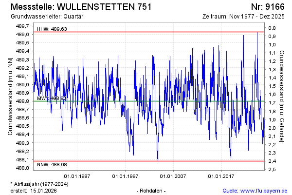
Groundwater level [m above sealevel]: 488.84
Distance to surface [m]: 1.64
Last value from 10.03.2026 09:24
Ground level [m above sealevel]: 490.48
| Date | Groundwater level [m above sealevel] |
|---|---|
| 10.03.2026 | 488.85 |
| 09.03.2026 | 488.86 |
| 08.03.2026 | 488.87 |
| 07.03.2026 | 488.88 |
| 06.03.2026 | 488.89 |
| 05.03.2026 | 488.90 |
| 04.03.2026 | 488.91 |
| 03.03.2026 | 488.92 |
© Bayerisches Landesamt für Umwelt 2026