
- Start >
- Groundwater >
- Waterlevel of upper layer >
- Bayern >
- Wolfersberg 2 >
- Chart of total period

Chart of total period Wolfersberg 2
Groundwater levels of the total period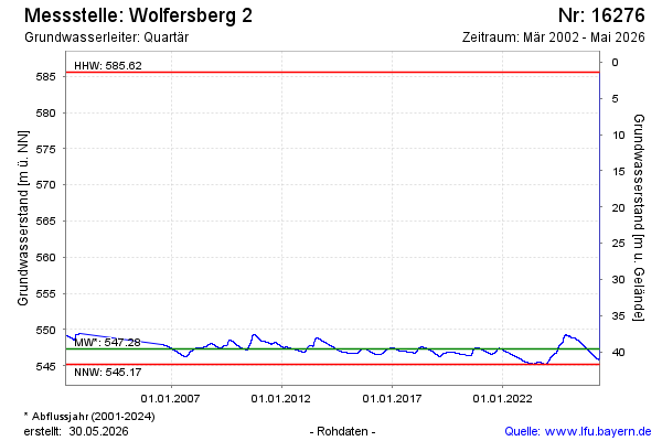
Groundwater level [m above sealevel]: 546.38
Distance to surface [m]: 40.55
Last value from 18.02.2026 09:29
Ground level [m above sealevel]: 586.93
| Date | Groundwater level [m above sealevel] |
|---|---|
| 18.02.2026 | 546.38 |
| 17.02.2026 | 546.38 |
| 16.02.2026 | 546.40 |
| 15.02.2026 | 546.40 |
| 14.02.2026 | 546.41 |
| 13.02.2026 | 546.42 |
| 12.02.2026 | 546.43 |
| 11.02.2026 | 546.44 |
© Bayerisches Landesamt für Umwelt 2026