
- Start >
- Groundwater >
- Waterlevel of upper layer >
- Bayern >
- WOEHR 145 A >
- Current data

Current data WOEHR 145 A
Groundwater levels of the last 12 months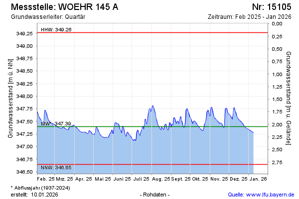
Groundwater level [m above sealevel]: 347.52
Distance to surface [m]: 1.92
Last value from 02.05.2024 10:00
Ground level [m above sealevel]: 349.44
| Date | Groundwater level [m above sealevel] |
|---|---|
| 02.05.2024 | 347.52 |
| 01.05.2024 | 347.53 |
| 30.04.2024 | 347.53 |
| 29.04.2024 | 347.54 |
| 28.04.2024 | 347.55 |
| 27.04.2024 | 347.56 |
| 26.04.2024 | 347.59 |
| 25.04.2024 | 347.61 |
© Bayerisches Landesamt für Umwelt 2024