
- Start >
- Groundwater >
- Waterlevel of upper layer >
- Bayern >
- WITTISLINGEN D 45 >
- Chart of total period

Chart of total period WITTISLINGEN D 45
Groundwater levels of the total period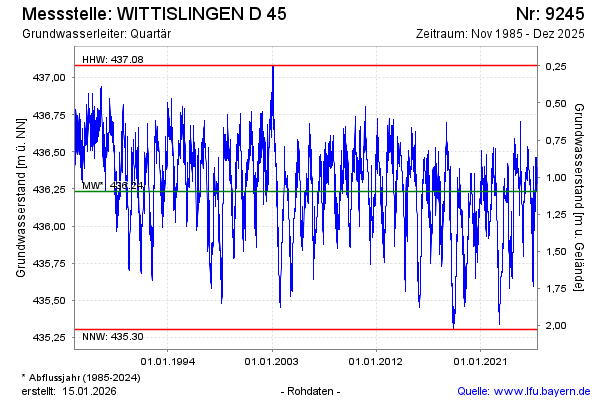
Groundwater level [m above sealevel]: 436.45
Distance to surface [m]: 0.88
Last value from 03.03.2026 14:37
Ground level [m above sealevel]: 437.33
| Date | Groundwater level [m above sealevel] |
|---|---|
| 03.03.2026 | 436.45 |
| 02.03.2026 | 436.46 |
| 01.03.2026 | 436.48 |
| 28.02.2026 | 436.49 |
| 27.02.2026 | 436.52 |
| 26.02.2026 | 436.54 |
| 25.02.2026 | 436.57 |
| 24.02.2026 | 436.60 |
© Bayerisches Landesamt für Umwelt 2026