
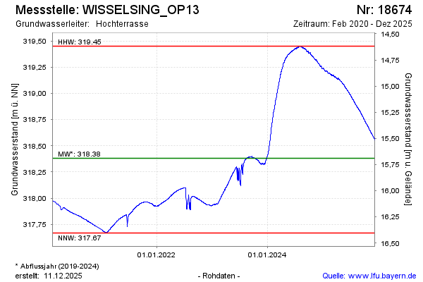
Chart of total period WISSELSING_OP13
Groundwater level [m above sealevel]: 318.03
Distance to surface [m]: 16.04
Last value from 13.07.2026 08:00
Ground level [m above sealevel]: 334.07
| Date | Groundwater level [m above sealevel] |
|---|---|
| 13.07.2026 | 318.04 |
| 12.07.2026 | 318.08 |
| 11.07.2026 | 318.12 |
| 10.07.2026 | 318.12 |
| 09.07.2026 | 318.12 |
| 08.07.2026 | 318.13 |
| 07.07.2026 | 318.13 |
| 06.07.2026 | 318.13 |