
- Start >
- Groundwater >
- Waterlevel of upper layer >
- Bayern >
- WIMPASING 611A P52080 >
- Year chart of precipitation

Year chart of precipitation WIMPASING 611A P52080
Groundwater levels of the last 12 months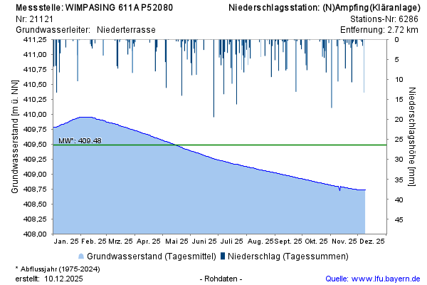
note
2010 Verlegung der Messstelle wegen Autobahnbau
Groundwater level [m above sealevel]: 408,67
Distance to surface [m]: 12,43
Last value from 13.04.2026 10:00
Ground level [m above sealevel]: 421.10
© Bayerisches Landesamt für Umwelt 2026