
- Start >
- Groundwater >
- Waterlevel of upper layer >
- Bayern >
- WILLING TANNENW.10 49 >
- Year chart of precipitation

Year chart of precipitation WILLING TANNENW.10 49
Groundwater levels of the last 12 months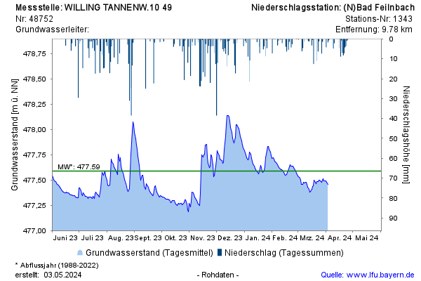
Groundwater level [m above sealevel]: 477,36
Distance to surface [m]: 1,92
Last value from 01.04.2026 11:37
Ground level [m above sealevel]: 479.28
© Bayerisches Landesamt für Umwelt 2026