
- Start >
- Groundwater >
- Waterlevel of upper layer >
- Bayern >
- WETTSTETTEN II 635 >
- Current data

Current data WETTSTETTEN II 635
Groundwater levels of the last 12 months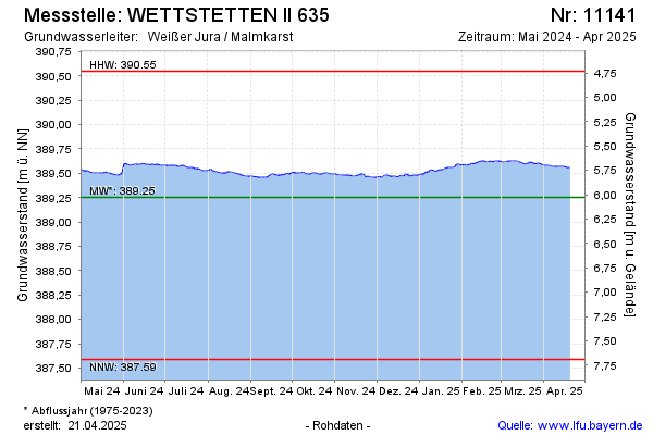
Groundwater level [m above sealevel]: 388.96
Distance to surface [m]: 6.32
Last value from 07.05.2026 10:00
Ground level [m above sealevel]: 395.28
| Date | Groundwater level [m above sealevel] |
|---|---|
| 07.05.2026 | 388.96 |
| 06.05.2026 | 388.97 |
| 05.05.2026 | 388.97 |
| 04.05.2026 | 388.97 |
| 03.05.2026 | 388.98 |
| 02.05.2026 | 388.97 |
| 01.05.2026 | 388.98 |
| 30.04.2026 | 388.98 |
© Bayerisches Landesamt für Umwelt 2026