
- Start >
- Groundwater >
- Waterlevel of upper layer >
- Bayern >
- WESTERRINGEN 90B >
- Chart of total period

Chart of total period WESTERRINGEN 90B
Groundwater levels of the total period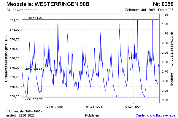
Groundwater level [m above sealevel]: 570.47
Distance to surface [m]: 2.18
Last value from 25.12.1995 12:00
Ground level [m above sealevel]: 572.65
| Date | Groundwater level [m above sealevel] |
|---|---|
| 18.12.1995 | 569.83 |
| 11.12.1995 | 569.91 |
| 04.12.1995 | 570.01 |
| 27.11.1995 | 570.05 |
| 20.11.1995 | 570.10 |
| 13.11.1995 | 569.58 |
| 06.11.1995 | 569.58 |
| 30.10.1995 | 569.60 |
© Bayerisches Landesamt für Umwelt 2026