
- Start >
- Groundwater >
- Waterlevel of upper layer >
- Bayern >
- WEILHEIM D 43 >
- Chart of total period

Chart of total period WEILHEIM D 43
Groundwater levels of the total period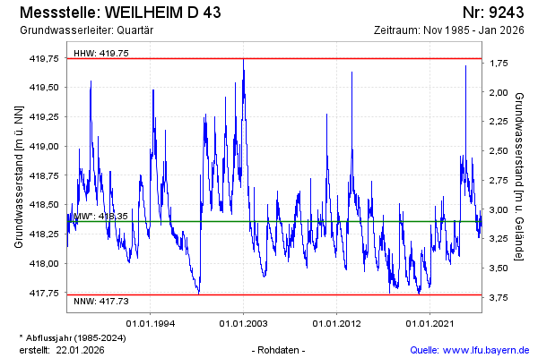
Groundwater level [m above sealevel]: 418.64
Distance to surface [m]: 2.82
Last value from 17.03.2026 12:59
Ground level [m above sealevel]: 421.46
| Date | Groundwater level [m above sealevel] |
|---|---|
| 17.03.2026 | 418.64 |
| 16.03.2026 | 418.65 |
| 15.03.2026 | 418.65 |
| 14.03.2026 | 418.68 |
| 13.03.2026 | 418.68 |
| 12.03.2026 | 418.67 |
| 11.03.2026 | 418.67 |
| 10.03.2026 | 418.68 |
© Bayerisches Landesamt für Umwelt 2026