
- Start >
- Groundwater >
- Waterlevel of upper layer >
- Bayern >
- Wegfurt N >
- Current data

Current data Wegfurt N
Groundwater levels of the last 12 months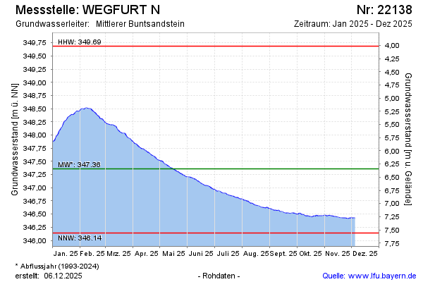
Groundwater level [m above sealevel]: 347.59
Distance to surface [m]: 6.13
Last value from 05.03.2026 10:00
Ground level [m above sealevel]: 353.72
| Date | Groundwater level [m above sealevel] |
|---|---|
| 05.03.2026 | 347.59 |
| 04.03.2026 | 347.57 |
| 03.03.2026 | 347.54 |
| 02.03.2026 | 347.51 |
| 01.03.2026 | 347.47 |
| 28.02.2026 | 347.44 |
| 27.02.2026 | 347.40 |
| 26.02.2026 | 347.34 |
© Bayerisches Landesamt für Umwelt 2026