
- Start >
- Groundwater >
- Waterlevel of upper layer >
- Bayern >
- Wassertrüdingen HW GWM 4 >
- Current data

Current data Wassertrüdingen HW GWM 4
Groundwater levels of the last 12 months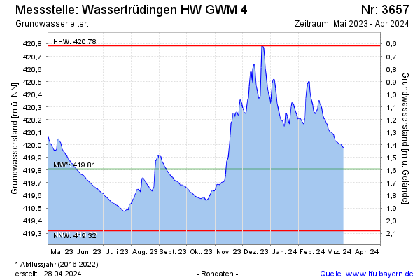
Groundwater level [m above sealevel]: 420.01
Distance to surface [m]: 1.39
Last value from 15.01.2026 14:00
Ground level [m above sealevel]: 421.40
| Date | Groundwater level [m above sealevel] |
|---|---|
| 15.01.2026 | 420.00 |
| 14.01.2026 | 419.97 |
| 13.01.2026 | 419.93 |
| 12.01.2026 | 419.90 |
| 11.01.2026 | 419.90 |
| 10.01.2026 | 419.90 |
| 09.01.2026 | 419.87 |
| 08.01.2026 | 419.85 |
© Bayerisches Landesamt für Umwelt 2026