
- Start >
- Groundwater >
- Waterlevel of upper layer >
- Bayern >
- Wassertrüdingen HW GWM 3 >
- Chart of total period

Chart of total period Wassertrüdingen HW GWM 3
Groundwater levels of the total period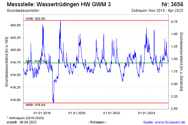
Groundwater level [m above sealevel]: 419.83
Distance to surface [m]: 1.49
Last value from 15.01.2026 14:00
Ground level [m above sealevel]: 421.32
| Date | Groundwater level [m above sealevel] |
|---|---|
| 15.01.2026 | 419.82 |
| 14.01.2026 | 419.80 |
| 13.01.2026 | 419.79 |
| 12.01.2026 | 419.78 |
| 11.01.2026 | 419.76 |
| 10.01.2026 | 419.76 |
| 09.01.2026 | 419.74 |
| 08.01.2026 | 419.71 |
© Bayerisches Landesamt für Umwelt 2026