
- Start >
- Groundwater >
- Waterlevel of upper layer >
- Bayern >
- WALLGAU 2 >
- Year chart of precipitation

Year chart of precipitation WALLGAU 2
Groundwater levels of the last 12 months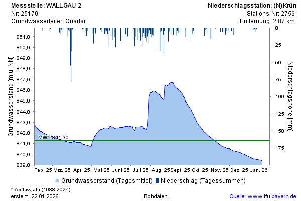
Groundwater level [m above sealevel]: 841,55
Distance to surface [m]: 9,38
Last value from 14.04.2026 23:00
Ground level [m above sealevel]: 850.93
© Bayerisches Landesamt für Umwelt 2026