
- Start >
- Groundwater >
- Waterlevel of upper layer >
- Bayern >
- Wald B (neu) KMS 11 >
- Chart of total period

Chart of total period Wald B (neu) KMS 11
Groundwater levels of the total period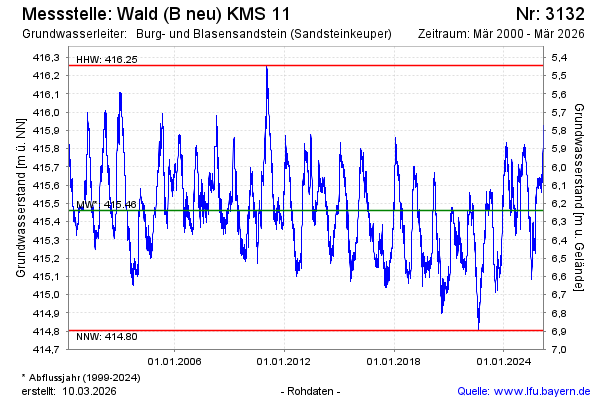
Groundwater level [m above sealevel]: 415.38
Distance to surface [m]: 6.32
Last value from 20.05.2026 13:00
Ground level [m above sealevel]: 421.70
| Date | Groundwater level [m above sealevel] |
|---|---|
| 20.05.2026 | 415.42 |
| 19.05.2026 | 415.43 |
| 18.05.2026 | 415.45 |
| 17.05.2026 | 415.45 |
| 16.05.2026 | 415.47 |
| 15.05.2026 | 415.49 |
| 14.05.2026 | 415.50 |
| 13.05.2026 | 415.49 |
© Bayerisches Landesamt für Umwelt 2026