
- Start >
- Groundwater >
- Waterlevel of upper layer >
- Bayern >
- WALD/A2-FLACHBR 762 >
- Chart of total period

Chart of total period WALD/A2-FLACHBR 762
Groundwater levels of the total period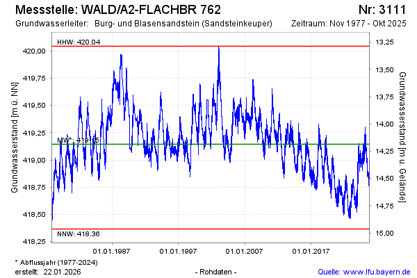
Groundwater level [m above sealevel]: 418.92
Distance to surface [m]: 14.41
Last value from 15.01.2026 12:00
Ground level [m above sealevel]: 433.33
| Date | Groundwater level [m above sealevel] |
|---|---|
| 15.01.2026 | 418.92 |
| 14.01.2026 | 418.92 |
| 13.01.2026 | 418.92 |
| 12.01.2026 | 418.91 |
| 11.01.2026 | 418.88 |
| 10.01.2026 | 418.98 |
| 09.01.2026 | 419.02 |
| 08.01.2026 | 418.96 |
© Bayerisches Landesamt für Umwelt 2026