
- Start >
- Groundwater >
- Waterlevel of upper layer >
- Bayern >
- Vötting >
- Chart of total period

Chart of total period Vötting
Groundwater levels of the total period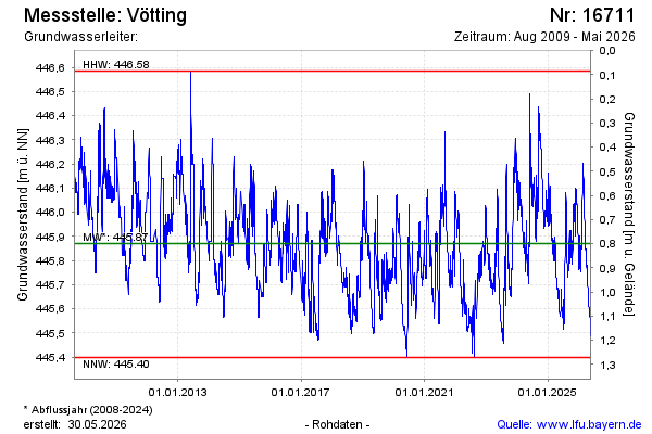
Groundwater level [m above sealevel]: 445.79
Distance to surface [m]: 0.88
Last value from 01.05.2024 09:00
Ground level [m above sealevel]: 446.67
| Date | Groundwater level [m above sealevel] |
|---|---|
| 01.05.2024 | 445.79 |
| 30.04.2024 | 445.81 |
| 29.04.2024 | 445.83 |
| 28.04.2024 | 445.86 |
| 27.04.2024 | 445.88 |
| 26.04.2024 | 445.90 |
| 25.04.2024 | 445.92 |
| 24.04.2024 | 445.94 |
© Bayerisches Landesamt für Umwelt 2024