
- Start >
- Groundwater >
- Waterlevel of upper layer >
- Bayern >
- Vöhringen, Schleifweg (Friedhof) N8 >
- Chart of total period

Chart of total period Vöhringen, Schleifweg (Friedhof) N8
Groundwater levels of the total period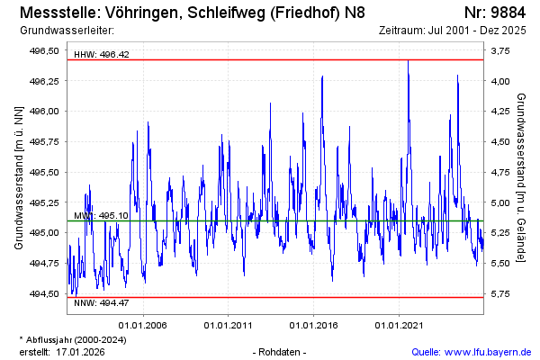
Groundwater level [m above sealevel]: 495.70
Distance to surface [m]: 4.55
Last value from 01.07.2024 14:05
Ground level [m above sealevel]: 500.25
| Date | Groundwater level [m above sealevel] |
|---|---|
| 01.07.2024 | 495.71 |
| 30.06.2024 | 495.72 |
| 29.06.2024 | 495.74 |
| 28.06.2024 | 495.75 |
| 27.06.2024 | 495.72 |
| 26.06.2024 | 495.72 |
| 25.06.2024 | 495.74 |
| 24.06.2024 | 495.75 |
© Bayerisches Landesamt für Umwelt 2024