
- Start >
- Groundwater >
- Waterlevel of upper layer >
- Bayern >
- Vöhringen, Kässbohrer Süd (BGW 5) >
- Current data

Current data Vöhringen, Kässbohrer Süd (BGW 5)
Groundwater levels of the last 12 months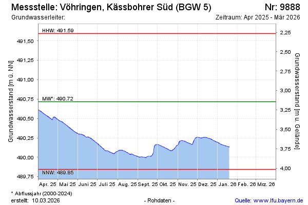
Groundwater level [m above sealevel]: 490.98
Distance to surface [m]: 2.88
Last value from 09.04.2024 12:27
Ground level [m above sealevel]: 493.86
| Date | Groundwater level [m above sealevel] |
|---|---|
| 09.04.2024 | 490.99 |
| 08.04.2024 | 490.99 |
| 07.04.2024 | 491.00 |
| 06.04.2024 | 491.00 |
| 05.04.2024 | 491.00 |
| 04.04.2024 | 491.00 |
| 03.04.2024 | 491.01 |
| 02.04.2024 | 491.01 |
© Bayerisches Landesamt für Umwelt 2024