
- Start >
- Groundwater >
- Waterlevel of upper layer >
- Bayern >
- Vöhringen, Bauschuttdeponie (M3) >
- Chart of total period

Chart of total period Vöhringen, Bauschuttdeponie (M3)
Groundwater levels of the total period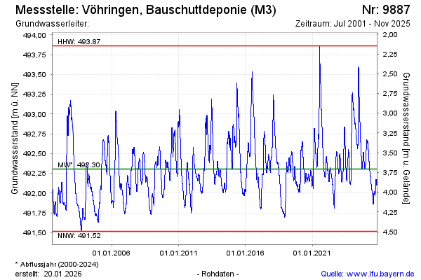
Groundwater level [m above sealevel]: 492.19
Distance to surface [m]: 3.82
Last value from 10.11.2025 09:11
Ground level [m above sealevel]: 496.01
| Date | Groundwater level [m above sealevel] |
|---|---|
| 10.11.2025 | 492.19 |
| 09.11.2025 | 492.19 |
| 08.11.2025 | 492.18 |
| 07.11.2025 | 492.18 |
| 06.11.2025 | 492.17 |
| 05.11.2025 | 492.16 |
| 04.11.2025 | 492.15 |
| 03.11.2025 | 492.14 |
© Bayerisches Landesamt für Umwelt 2026