
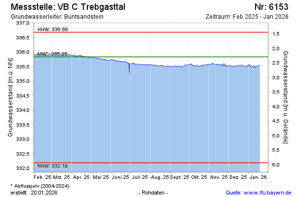
Current data VB C Trebgasttal
Groundwater level [m above sealevel]: 335,62
Distance to surface [m]: 2,51
Last value from 29.07.2026 09:00
Ground level [m above sealevel]: 338.13
| Date | Groundwater level [m above sealevel] |
|---|---|
| 29.07.2026 | 335.62 |
| 28.07.2026 | 335.61 |
| 27.07.2026 | 335.64 |
| 26.07.2026 | 335.67 |
| 25.07.2026 | 335.68 |
| 24.07.2026 | 335.66 |
| 23.07.2026 | 335.67 |
| 22.07.2026 | 335.66 |