
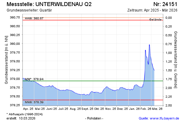
Current data UNTERWILDENAU Q2
Groundwater level [m above sealevel]: 378.61
Distance to surface [m]: 2.13
Last value from 15.07.2026 04:00
Ground level [m above sealevel]: 380.74
| Date | Groundwater level [m above sealevel] |
|---|---|
| 14.07.2026 | 378.61 |
| 13.07.2026 | 378.62 |
| 12.07.2026 | 378.62 |
| 11.07.2026 | 378.63 |
| 10.07.2026 | 378.63 |
| 09.07.2026 | 378.64 |
| 08.07.2026 | 378.65 |
| 07.07.2026 | 378.66 |