
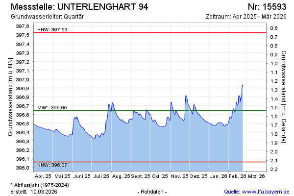
Current data UNTERLENGHART 94
Groundwater level [m above sealevel]: 396.30
Distance to surface [m]: 1.88
Last value from 02.06.2026 10:20
Ground level [m above sealevel]: 398.18
| Date | Groundwater level [m above sealevel] |
|---|---|
| 02.06.2026 | 396.30 |
| 01.06.2026 | 396.29 |
| 31.05.2026 | 396.28 |
| 30.05.2026 | 396.28 |
| 29.05.2026 | 396.29 |
| 28.05.2026 | 396.30 |
| 27.05.2026 | 396.32 |
| 26.05.2026 | 396.33 |