
Chart of total period UNTEREICHEN 933
Groundwater level [m above sealevel]: 518.77
Distance to surface [m]: 4.54
Last value from 31.10.1992 23:59
Ground level [m above sealevel]: 523.31
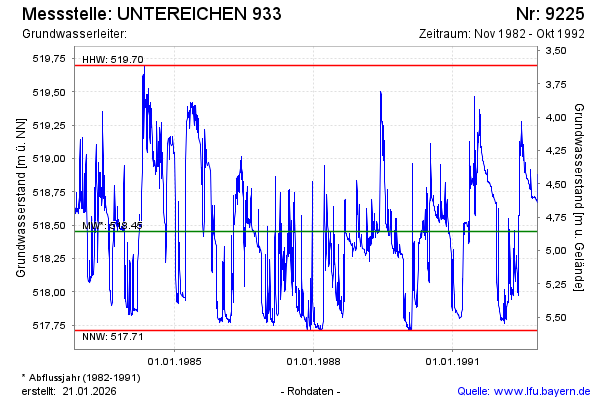
| Date | Groundwater level [m above sealevel] |
|---|---|
| 31.10.1992 | 518.81 |
| 30.10.1992 | 518.88 |
| 29.10.1992 | 518.83 |
| 28.10.1992 | 518.78 |
| 27.10.1992 | 518.80 |
| 26.10.1992 | 518.80 |
| 25.10.1992 | 518.69 |
| 24.10.1992 | 518.67 |