
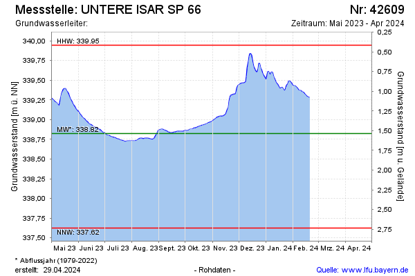
Current data UNTERE ISAR SP 66
Groundwater level [m above sealevel]: 338,74
Distance to surface [m]: 1,62
Last value from 13.05.2026 09:35
Ground level [m above sealevel]: 340.36
| Date | Groundwater level [m above sealevel] |
|---|---|
| 13.05.2026 | 338.74 |
| 12.05.2026 | 338.73 |
| 11.05.2026 | 338.73 |
| 10.05.2026 | 338.73 |
| 09.05.2026 | 338.73 |
| 08.05.2026 | 338.73 |
| 07.05.2026 | 338.72 |
| 06.05.2026 | 338.71 |