
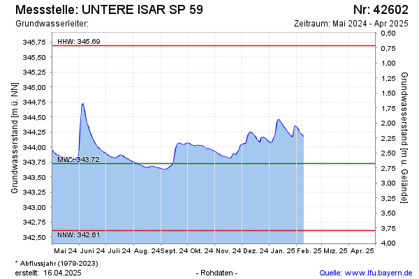
Current data UNTERE ISAR SP 59
Groundwater level [m above sealevel]: 343.63
Distance to surface [m]: 2.77
Last value from 19.05.2026 07:55
Ground level [m above sealevel]: 346.40
| Date | Groundwater level [m above sealevel] |
|---|---|
| 19.05.2026 | 343.63 |
| 18.05.2026 | 343.63 |
| 17.05.2026 | 343.63 |
| 16.05.2026 | 343.62 |
| 15.05.2026 | 343.61 |
| 14.05.2026 | 343.59 |
| 13.05.2026 | 343.58 |
| 12.05.2026 | 343.57 |