
- Start >
- Groundwater >
- Waterlevel of upper layer >
- Bayern >
- TYRLACHING BR 3 764 >
- Chart of total period

Chart of total period TYRLACHING BR 3 764
Groundwater levels of the total period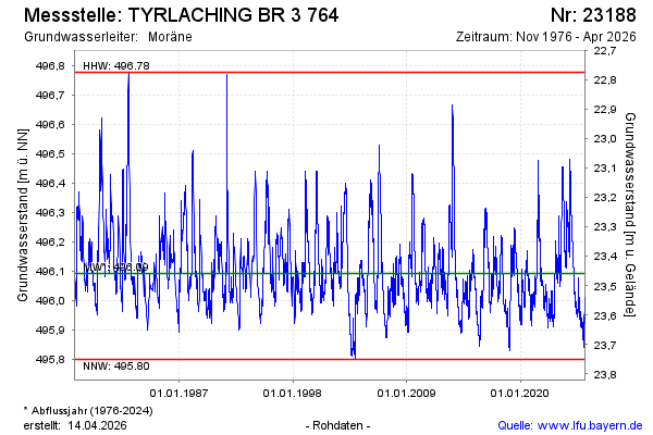
Groundwater level [m above sealevel]: 496.00
Distance to surface [m]: 23.55
Last value from 02.03.2026 14:55
Ground level [m above sealevel]: 519.55
| Date | Groundwater level [m above sealevel] |
|---|---|
| 02.03.2026 | 496.00 |
| 01.03.2026 | 495.99 |
| 28.02.2026 | 495.98 |
| 27.02.2026 | 495.96 |
| 26.02.2026 | 495.94 |
| 25.02.2026 | 495.93 |
| 24.02.2026 | 495.91 |
| 23.02.2026 | 495.90 |
© Bayerisches Landesamt für Umwelt 2026