
- Start >
- Groundwater >
- Waterlevel of upper layer >
- Bayern >
- Türkheim Kieswerk Dachser B1 >
- Chart of total period

Chart of total period Türkheim Kieswerk Dachser B1
Groundwater levels of the total period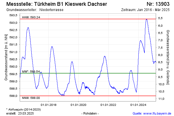
Groundwater level [m above sealevel]: 588.29
Distance to surface [m]: 10.51
Last value from 18.11.2025 10:00
Ground level [m above sealevel]: 598.80
| Date | Groundwater level [m above sealevel] |
|---|---|
| 04.11.2025 | 588.35 |
| 03.11.2025 | 588.35 |
| 02.11.2025 | 588.33 |
| 01.11.2025 | 588.37 |
| 31.10.2025 | 588.41 |
| 30.10.2025 | 588.41 |
| 29.10.2025 | 588.39 |
| 28.10.2025 | 588.37 |
© Bayerisches Landesamt für Umwelt 2025