
- Start >
- Groundwater >
- Waterlevel of upper layer >
- Bayern >
- Tiefenstockheim MU 14 >
- Current data

Current data Tiefenstockheim MU 14
Groundwater levels of the last 12 months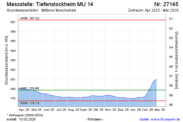
Groundwater level [m above sealevel]: 179.83
Distance to surface [m]: 58.51
Last value from 02.05.2024 10:00
Ground level [m above sealevel]: 238.34
| Date | Groundwater level [m above sealevel] |
|---|---|
| 02.05.2024 | 179.84 |
| 01.05.2024 | 179.84 |
| 30.04.2024 | 179.84 |
| 29.04.2024 | 179.84 |
| 28.04.2024 | 179.87 |
| 27.04.2024 | 179.90 |
| 26.04.2024 | 179.92 |
| 25.04.2024 | 179.93 |
© Bayerisches Landesamt für Umwelt 2024