
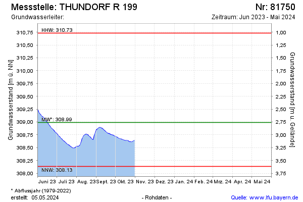
Current data THUNDORF R 199
Groundwater level [m above sealevel]: 308,52
Distance to surface [m]: 3,23
Last value from 31.10.2025 18:00
Ground level [m above sealevel]: 311.75
| Date | Groundwater level [m above sealevel] |
|---|---|
| 31.12.2024 | 309.46 |
| 30.12.2024 | 309.48 |
| 29.12.2024 | 309.51 |
| 28.12.2024 | 309.54 |
| 27.12.2024 | 309.57 |
| 26.12.2024 | 309.58 |
| 25.12.2024 | 309.59 |
| 24.12.2024 | 309.61 |