
- Start >
- Groundwater >
- Waterlevel of upper layer >
- Bayern >
- Theinfeld (tief) kmM 1 >
- Current data

Current data Theinfeld (tief) kmM 1
Groundwater levels of the last 12 months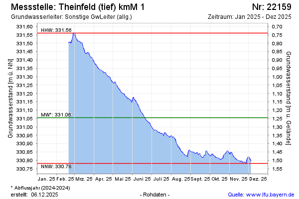
Groundwater level [m above sealevel]: 331.14
Distance to surface [m]: 1.16
Last value from 04.05.2026 09:00
Ground level [m above sealevel]: 332.30
| Date | Groundwater level [m above sealevel] |
|---|---|
| 04.05.2026 | 331.14 |
| 03.05.2026 | 331.14 |
| 02.05.2026 | 331.14 |
| 01.05.2026 | 331.15 |
| 30.04.2026 | 331.15 |
| 29.04.2026 | 331.16 |
| 28.04.2026 | 331.17 |
| 27.04.2026 | 331.17 |
© Bayerisches Landesamt für Umwelt 2026