
- Start >
- Groundwater >
- Waterlevel of upper layer >
- Bayern >
- Südl. Freising M 8 >
- Current data

Current data Südl. Freising M 8
Groundwater levels of the last 12 months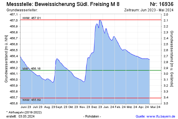
Groundwater level [m above sealevel]: 456.32
Distance to surface [m]: 2.78
Last value from 05.03.2026 10:00
Ground level [m above sealevel]: 459.10
| Date | Groundwater level [m above sealevel] |
|---|---|
| 05.03.2026 | 456.32 |
| 04.03.2026 | 456.32 |
| 03.03.2026 | 456.32 |
| 02.03.2026 | 456.31 |
| 01.03.2026 | 456.31 |
| 28.02.2026 | 456.28 |
| 27.02.2026 | 456.25 |
| 26.02.2026 | 456.20 |
© Bayerisches Landesamt für Umwelt 2026