Year chart of precipitation STRULLENDORF 63B
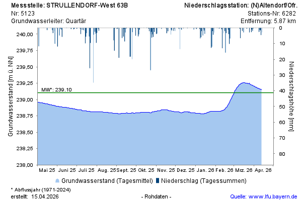
Groundwater level [m above sealevel]: 238,87
Distance to surface [m]: 4,43
Last value from 10.07.2026 10:00
Ground level [m above sealevel]: 243.30

Groundwater level [m above sealevel]: 238,87
Distance to surface [m]: 4,43
Last value from 10.07.2026 10:00
Ground level [m above sealevel]: 243.30