
- Start >
- Groundwater >
- Waterlevel of upper layer >
- Bayern >
- Straubing-B1-2019 >
- Chart of total period

Chart of total period Straubing-B1-2019
Groundwater levels of the total period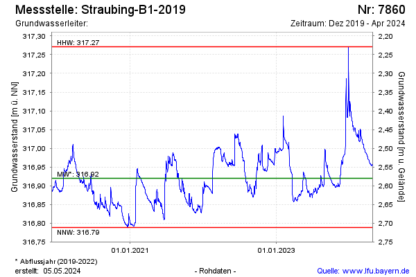
Groundwater level [m above sealevel]: 316.95
Distance to surface [m]: 2.55
Last value from 07.08.2025 13:14
Ground level [m above sealevel]: 319.50
| Date | Groundwater level [m above sealevel] |
|---|---|
| 07.08.2025 | 317.00 |
| 06.08.2025 | 316.95 |
| 05.08.2025 | 316.95 |
| 04.08.2025 | 316.95 |
| 03.08.2025 | 316.94 |
| 02.08.2025 | 316.94 |
| 01.08.2025 | 316.94 |
| 31.07.2025 | 316.94 |
© Bayerisches Landesamt für Umwelt 2026