
Chart of total period STEINHEIM 14B
Groundwater level [m above sealevel]: 467,02
Distance to surface [m]: 3,43
Last value from 25.01.1993 12:00
Ground level [m above sealevel]: 470.45
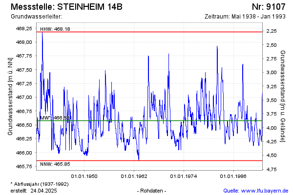
| Date | Groundwater level [m above sealevel] |
|---|---|
| 18.01.1993 | 467.03 |
| 11.01.1993 | 467.03 |
| 04.01.1993 | 467.05 |
| 28.12.1992 | 467.08 |
| 21.12.1992 | 467.08 |
| 14.12.1992 | 466.97 |
| 07.12.1992 | 466.78 |
| 30.11.1992 | 466.57 |