
- Start >
- Groundwater >
- Waterlevel of upper layer >
- Bayern >
- STEINA VB 1 >
- Chart of total period

Chart of total period STEINA VB 1
Groundwater levels of the total period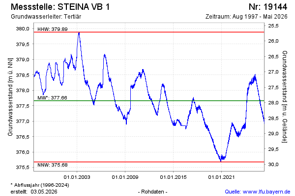
note
GW Messstelle im Verdichtungsnetz
Groundwater level [m above sealevel]: 376.83
Distance to surface [m]: 28.77
Last value from 29.05.2026 08:00
Ground level [m above sealevel]: 405.60
| Date | Groundwater level [m above sealevel] |
|---|---|
| 29.05.2026 | 376.83 |
| 28.05.2026 | 376.84 |
| 27.05.2026 | 376.85 |
| 26.05.2026 | 376.83 |
| 25.05.2026 | 376.83 |
| 24.05.2026 | 376.84 |
| 23.05.2026 | 376.84 |
| 22.05.2026 | 376.84 |
© Bayerisches Landesamt für Umwelt 2026