
- Start >
- Groundwater >
- Waterlevel of upper layer >
- Bayern >
- STEGAURACH 236 >
- Chart of total period

Chart of total period STEGAURACH 236
Groundwater levels of the total period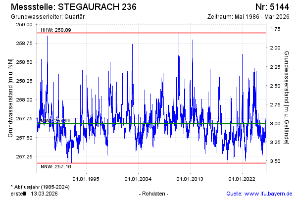
Groundwater level [m above sealevel]: 257.67
Distance to surface [m]: 3.02
Last value from 15.04.2026 09:29
Ground level [m above sealevel]: 260.69
| Date | Groundwater level [m above sealevel] |
|---|---|
| 15.04.2026 | 257.66 |
| 14.04.2026 | 257.66 |
| 13.04.2026 | 257.64 |
| 12.04.2026 | 257.62 |
| 11.04.2026 | 257.61 |
| 10.04.2026 | 257.62 |
| 09.04.2026 | 257.60 |
| 08.04.2026 | 257.60 |
© Bayerisches Landesamt für Umwelt 2026