
- Start >
- Groundwater >
- Waterlevel of upper layer >
- Bayern >
- Stadeln Q4 >
- Chart of total period

Chart of total period Stadeln Q4
Groundwater levels of the total period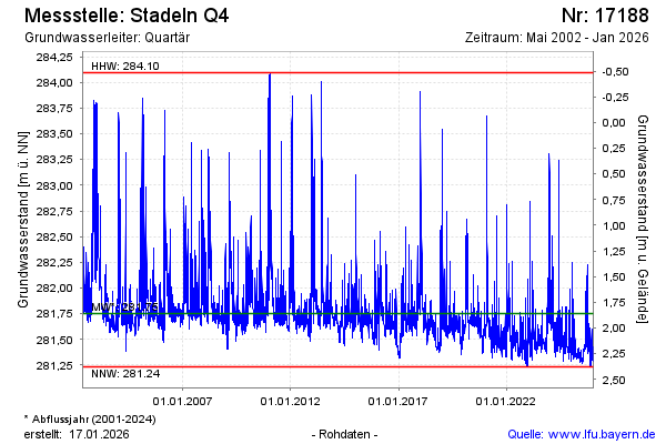
Groundwater level [m above sealevel]: 281.41
Distance to surface [m]: 2.20
Last value from 18.05.2026 07:21
Ground level [m above sealevel]: 283.61
| Date | Groundwater level [m above sealevel] |
|---|---|
| 18.05.2026 | 281.43 |
| 17.05.2026 | 281.44 |
| 16.05.2026 | 281.47 |
| 15.05.2026 | 281.46 |
| 14.05.2026 | 281.46 |
| 13.05.2026 | 281.46 |
| 12.05.2026 | 281.50 |
| 11.05.2026 | 281.46 |
© Bayerisches Landesamt für Umwelt 2026