
- Start >
- Groundwater >
- Waterlevel of upper layer >
- Bayern >
- STACHUS NORD 606 >
- Current data

Current data STACHUS NORD 606
Groundwater levels of the last 12 months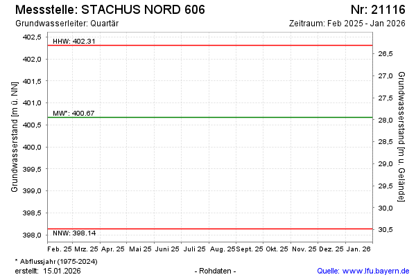
note
Die Messstelle wird nicht mehr beobachtet
Groundwater level [m above sealevel]: 399.91
Distance to surface [m]: 28.71
Last value from 16.10.2025 16:51
Ground level [m above sealevel]: 428.62
| Date | Groundwater level [m above sealevel] |
|---|---|
| 10.10.2024 | 400.73 |
| 18.04.2024 | 400.34 |
| 19.10.2023 | 399.24 |
| 19.04.2023 | 398.88 |
| 18.10.2022 | 398.80 |
| 12.04.2022 | 398.70 |
| 12.10.2021 | 398.41 |
| 14.04.2021 | 398.14 |
© Bayerisches Landesamt für Umwelt 2026